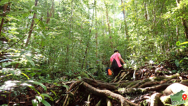
One of the best place to visit in Santubong without a doubt will be the hidden valley. I visited this place before here, and always wanted to come back again. Notice the trail had change a lot geographically, it seems that the rocks are getting closer with each others, and there are less huge rocks along the trail.
Image capture by my drone, when it reach at about 200 meter of height, it suddenly disconnected 😟 I tried to press on a few button on the remote in hope to regain the connection but fail.
And after a few second, the auto return home was activated, and while it descent to a certain height, i regain the connection again, and quickly land the drone manually. It was a close call ~~~
This trip is to explore the east side of the Santubong peninsular, and continue with a steep hike up to Santubong summit no.3 at 815m ASL. The total trip took me about 15 hours to complete, and this is the first time I hike for so long in one day.
Start our journey at the Jalan Sultan Tengah, 400m away from the Cove 55 hotel. We start at 6am sharp.
A lot of steam crossing, I hike to this place before while on my way to Nanga Shanti.
Crystal clear stream flows all the way from Santubong, and our mission today is to explore to the source of this stream.
Unknown fruits on the bank.
The Santubong Eastern Waterfall, estimate about 40 meter drop. One of the highest waterfall in Kuching area. Reach this waterfall at 10.40am
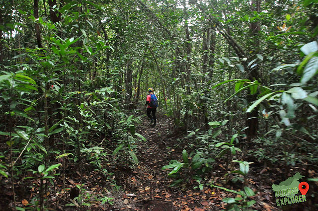
Continue on with our jorney to Santubong Summit No.3
Almost reach the source of the waterfall, from this point onwards the water are getting less and less.
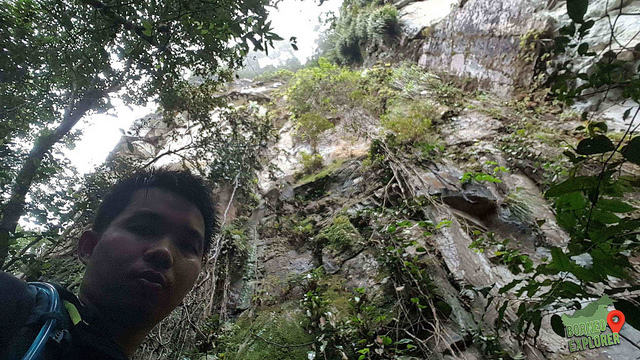
Breathtaking view on the edge of the cliff
Finally reached Santubong summit no.3 at about 4.30pm
A very challenging trail, and we all had reach the Santubong park HQ at 10pm.
This tree are so huge, I estimate will need about 5 - 6 adults holding hands to circle the tree trunk.
一颗百年大树。至少要五,六人才能围一圈这颗大树。
The higher we go, the steeper it gets. Need a lot of strength to slowly hike up
越高越钭,我就越走越吃力。脚软了~
Almost reach the summit after 3 hours of hike
大概三个小时后,终于要到山顶了
This is the highest point of Gunung Rawan, there is a border stone on the highest point. No view on the summit, however there is a viewpoint nearby. But unfortunately all cover by fog.
Me and the border stone. One side is Kalimantan, another side is Sarawak, Borneo.
我与边界石。一边是加里曼丹,一边是砂拉越
WHERE IS MOUNT RAWAN 拉旺山在哪里
From Kuching town, drive all the way to Serian, then Tebedu. Then drive all the way to Kujang Sain, there are road sign along the way. The mount Rawan its situated at Kampung Kujang Sain, a village near the Kalimantan, Indonesia border. 古晋开车到西连,在到 TEBEDU,在开车到 KUJAN SAIN 村落。一路上都有路牌,不会迷路。