Mini Series of Mount Santubong
Mount Santubong Post 1 of 3
Mount Santubong Post 2 of 3
Mount Santubong Post 3 of 3
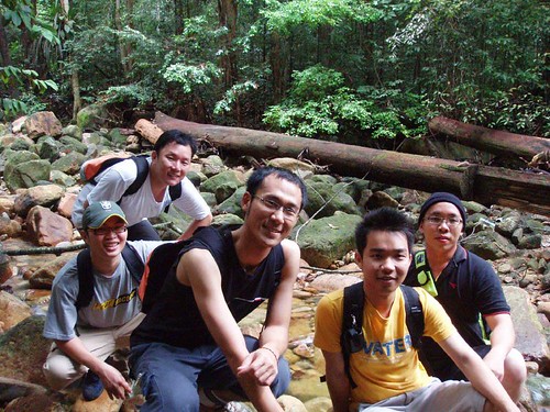
The night before I had fever, I didn’t take medicine as I tough it will be ok the other day. I wake up around 2am, my head is aching. Should I cancel the trip tomorrow? I lye on my bed and fall asleep, I woke up again, the time was 5am. I feel cold, I wake up and read book to kill time. I wanted to have breakfast, but no appetite. 6.30am, give my friend a morning call, he’s up. Reach my place around 7am. We went to King Center for breakfast; I still feel headache, and a bit of fever. 7.30am, everyone arrive at the meeting point. There are five of us, Kuching is a small place, when the four of them meet up they have seen each other before.
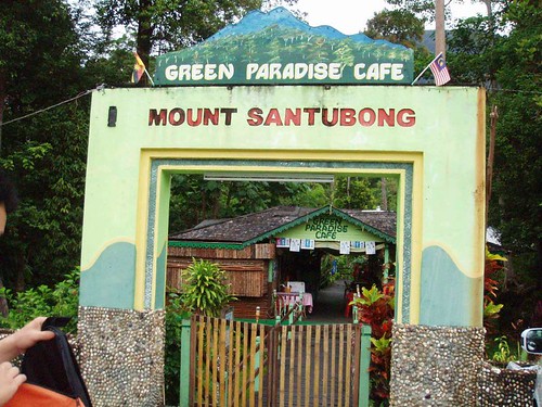
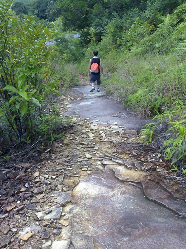
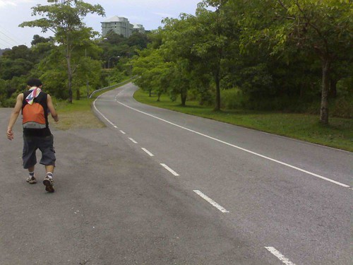
It took us 40 minutes drive to Santubong. There are two places to start the journey; we choose the one at the Green Paradise Café. The path here will be rough than the other one. We choose here cause our car is taken care by the café owner.

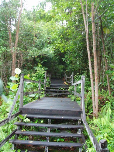
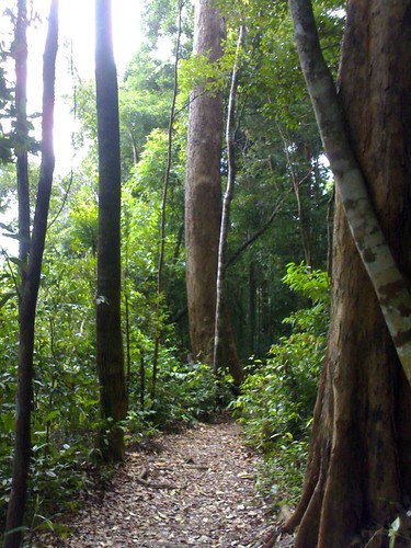
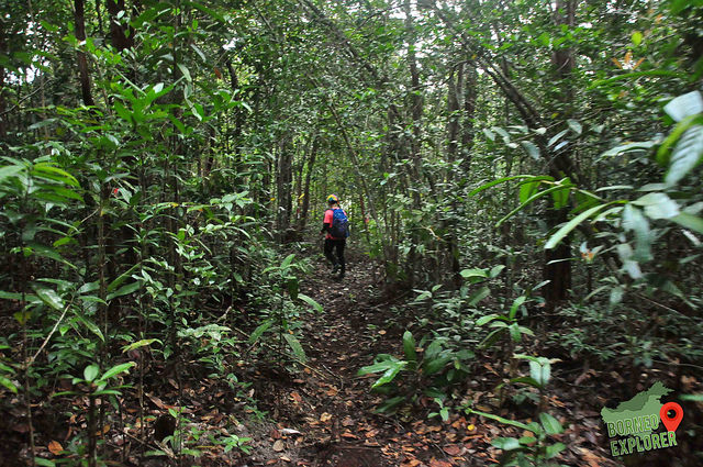
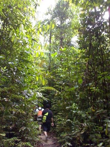
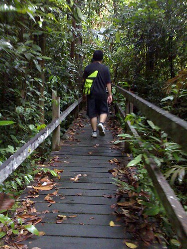
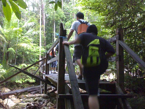
We have to register our car plate number, our name and pay RM1 for the entrance fees. There is a wooden path to lead us into the jungle, the path look very old and fragile, it can collapse anytime. There is stream water flowing down from the mountain. The weather is a bit drizzling. Despite not feeling well, but I’m still exited, and looking forward to conquer mount Santubong. The time now is 8.45am.
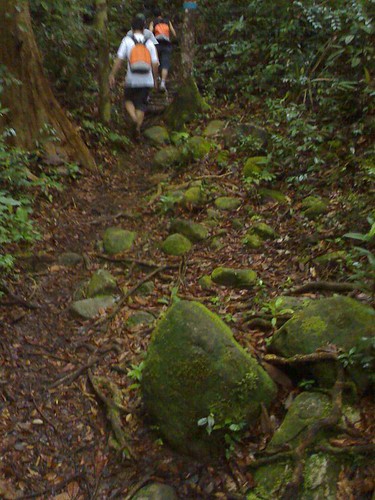
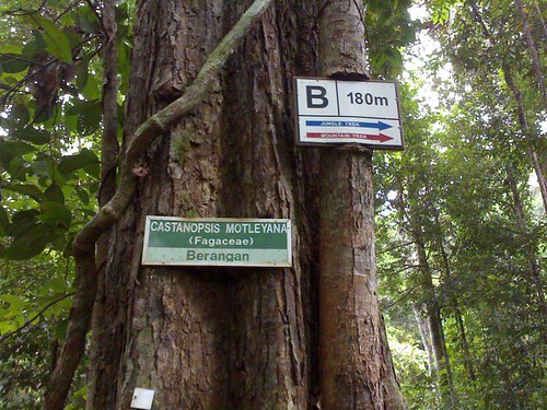
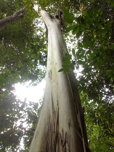
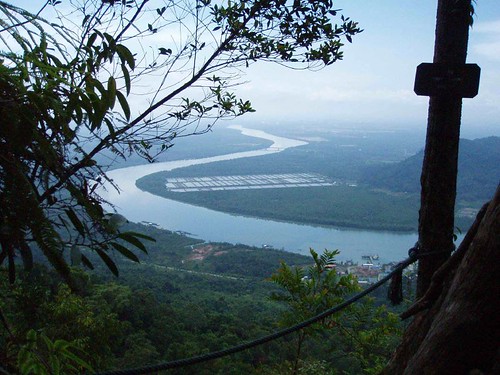
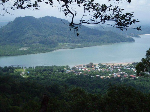
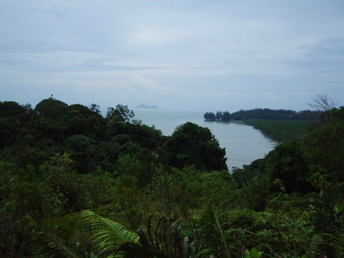
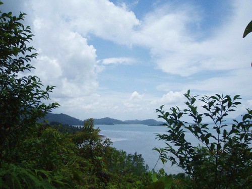
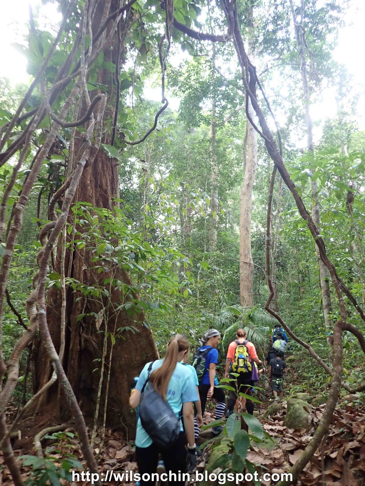
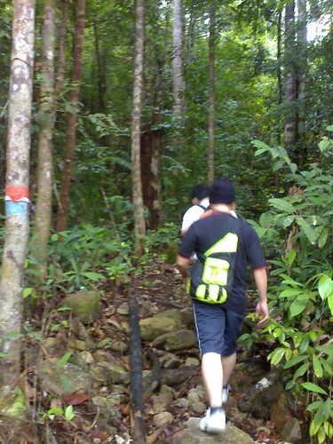
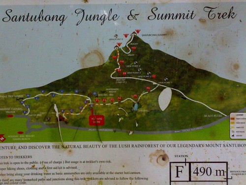
We on now are the jungle track. There is a label on each station, the label indicate the distant that we have gone so far. Among the five of us I’m the last in the team, as I stop for photos frequently.
There are five of us
1. Bong
2. Austin
3. Peter
4. Chua
5. Wilson (Me)
The time was now 9am, we stop for rest. Bong had climbed Santubong for five times, Austin and Peter second time, Chua and Me first time. Peter told us a story, he said long time ago, there are five idiots who spend their Sunday by driving all the way from Kuching, to come to Santubong, and suffer. Bong continues the story by this five people can just sleep at home, and watch television enjoy the weekend. But this idiot don’t like to enjoy life, they like to get tired, wet by the rain, dirty.
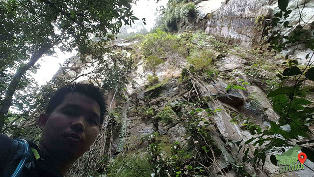
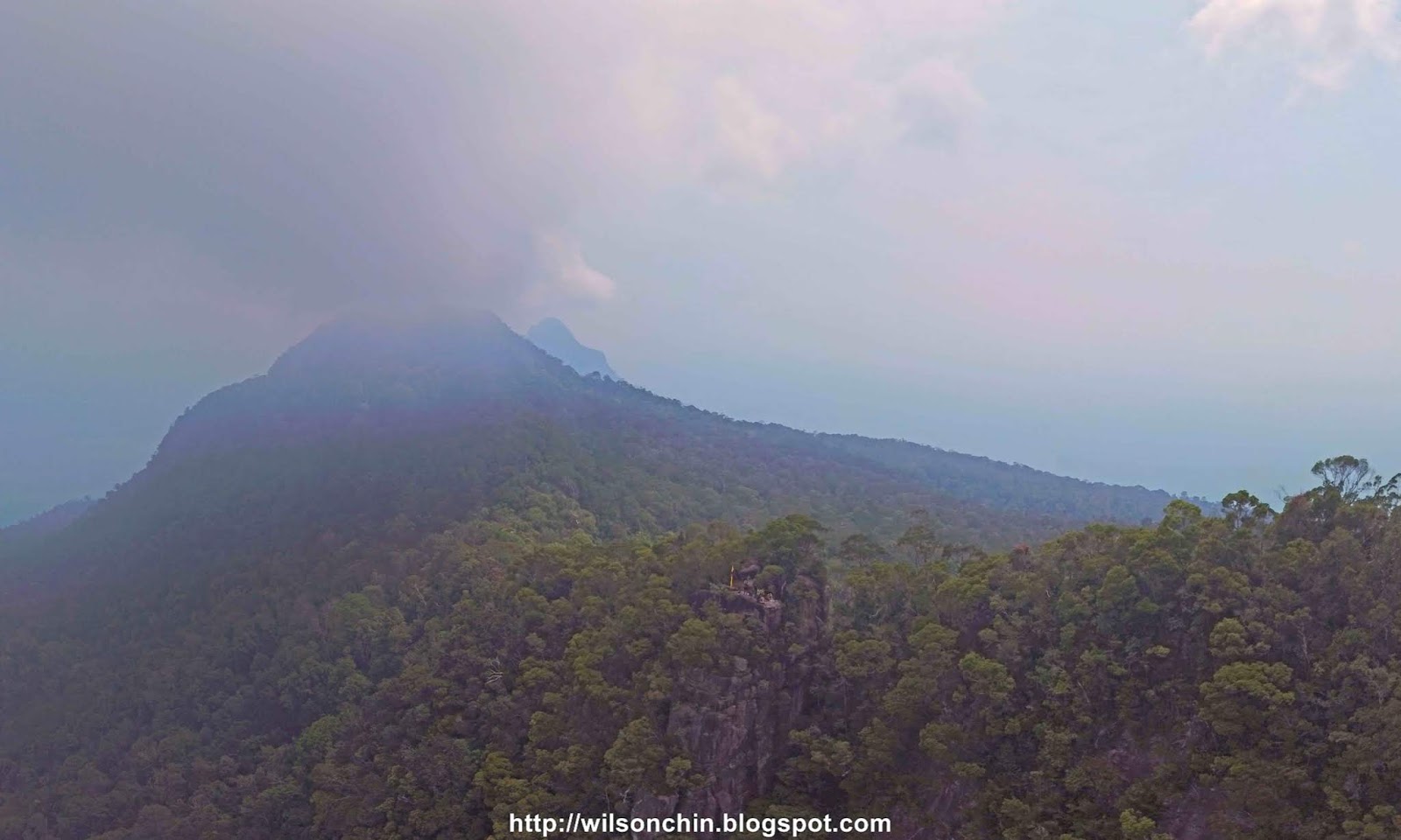
This track is very easy to walk, what I heard is that Santubong is a stiff climb. Some part is as slant as 90 degree. But this is really piece of cake.
The track is very wet, though is a piece of cake, but I’m sweating. Before climbing Santubong, I should do regular exercise. Very hard for me to catch my breath and among the five of us Bong and Peter have the best stamina. Bong is an adventurers, he had participate something like iron man competition at Kuching where you need to run for a few kilometer then continue by swim, and then bicycle for a few kilometer again. Peter is a smoker, but he does regular exercise. And the three of us, only exercise when are too bored.
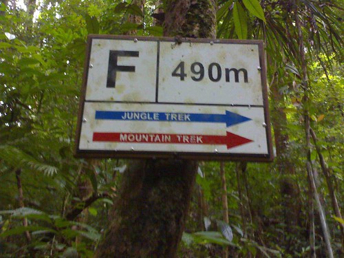
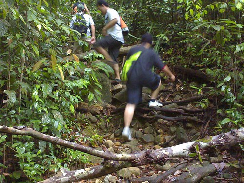
We had reached the final station of the jungle trek, after this is Mountain trek which will be indicated by red arrow. If you’re the first time here, there will be red mark on the tress all the way to the top. So just have to follow the red marks, now we have gone a total of 490 meter so far. From here to the top we have a total of 15 stations to go.
I tough after sweating I’ll feel better, but is still the same. My fever and headache still killing me, they all told me that my face look very white, I didn’t told them I’m not feeling well, cause I don’t want to spoil their mood, after all I’m the one who organize this trip so I must keep going. That time, the only thing in my mind that is to reach to the summit. So I keep on going, but along the way my body keeps on telling me to stop, and turn back. Is a fight between my mind and body now, what is my limit? I’ll find the answer along the way.
Mount Santubong Post 1 of 3
Mount Santubong Post 2 of 3
Mount Santubong Post 3 of 3
The night before I had fever, I didn’t take medicine as I tough it will be ok the other day. I wake up around 2am, my head is aching. Should I cancel the trip tomorrow? I lye on my bed and fall asleep, I woke up again, the time was 5am. I feel cold, I wake up and read book to kill time. I wanted to have breakfast, but no appetite. 6.30am, give my friend a morning call, he’s up. Reach my place around 7am. We went to King Center for breakfast; I still feel headache, and a bit of fever. 7.30am, everyone arrive at the meeting point. There are five of us, Kuching is a small place, when the four of them meet up they have seen each other before.
It took us 40 minutes drive to Santubong. There are two places to start the journey; we choose the one at the Green Paradise Café. The path here will be rough than the other one. We choose here cause our car is taken care by the café owner.
We have to register our car plate number, our name and pay RM1 for the entrance fees. There is a wooden path to lead us into the jungle, the path look very old and fragile, it can collapse anytime. There is stream water flowing down from the mountain. The weather is a bit drizzling. Despite not feeling well, but I’m still exited, and looking forward to conquer mount Santubong. The time now is 8.45am.
We on now are the jungle track. There is a label on each station, the label indicate the distant that we have gone so far. Among the five of us I’m the last in the team, as I stop for photos frequently.
There are five of us
1. Bong
2. Austin
3. Peter
4. Chua
5. Wilson (Me)
The time was now 9am, we stop for rest. Bong had climbed Santubong for five times, Austin and Peter second time, Chua and Me first time. Peter told us a story, he said long time ago, there are five idiots who spend their Sunday by driving all the way from Kuching, to come to Santubong, and suffer. Bong continues the story by this five people can just sleep at home, and watch television enjoy the weekend. But this idiot don’t like to enjoy life, they like to get tired, wet by the rain, dirty.
This track is very easy to walk, what I heard is that Santubong is a stiff climb. Some part is as slant as 90 degree. But this is really piece of cake.
The track is very wet, though is a piece of cake, but I’m sweating. Before climbing Santubong, I should do regular exercise. Very hard for me to catch my breath and among the five of us Bong and Peter have the best stamina. Bong is an adventurers, he had participate something like iron man competition at Kuching where you need to run for a few kilometer then continue by swim, and then bicycle for a few kilometer again. Peter is a smoker, but he does regular exercise. And the three of us, only exercise when are too bored.
We had reached the final station of the jungle trek, after this is Mountain trek which will be indicated by red arrow. If you’re the first time here, there will be red mark on the tress all the way to the top. So just have to follow the red marks, now we have gone a total of 490 meter so far. From here to the top we have a total of 15 stations to go.
I tough after sweating I’ll feel better, but is still the same. My fever and headache still killing me, they all told me that my face look very white, I didn’t told them I’m not feeling well, cause I don’t want to spoil their mood, after all I’m the one who organize this trip so I must keep going. That time, the only thing in my mind that is to reach to the summit. So I keep on going, but along the way my body keeps on telling me to stop, and turn back. Is a fight between my mind and body now, what is my limit? I’ll find the answer along the way.