I visited Lingga town after I finished my hike to Bukit Sium at Batang Ai. This is a small coastal town which can be reach by road via Sri Aman town, the road condition are acceptable, as its tar road from Sri Aman town all the way to Lingga town. The Lingga town its situated near the Lupar River (Batang Lupar) debouches into the South China Sea.
完成我的休谟无卡山探险记,巴当艾河国家公园。我拜访了笼芽镇,这是一个在海外的小镇。从诗里阿曼可以开车到,泊油路。路况还可以接受,笼芽镇是在 LUPAR 河的对面而已。
There is only one row of Chinese shop house situated near the river bank.
笼芽镇只有一排华人店屋,对面就是河。
One thing that caught my attention was the first, second, third, and fourth shop house, the structure are beginning to lean to the left. After a few more years, it might even collapse if no repair work.
这排老店特别的就是前第一,二,三及第四间已经开始稍微斜去左边。如果再没有维修,几年后恐怕会倒塌。
Every morning the shop will open at about 7.30am - 8am, and people will come for breakfast, and buy some food. The kuih they sell here are cheaper than what we get from the city.
每个早上,这些店铺在八点前就开门做生意。当地的村民们就会来早餐,购买食物。
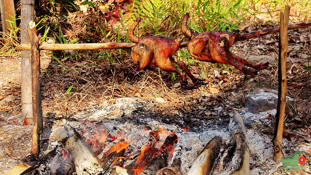
On the sky of Lingga town, we saw a rare scenery, a huge swarm of bats flew over the sky.
The Batang Ai National Park jetty, the only was to go to either the longhouse, the Park HQ, or the mountains nearby is by boat.
巴当艾河国家公园的码头。去长屋,还是去爬山的唯一路线就只有乘船。
A group photo at the Batang Ai Dam. this dam was completed in 1985
在水坝旁边来一张合照。巴当艾的水坝1985年完工。
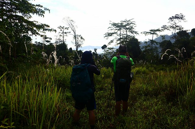
Sun Halo on our hiking day to Bukit Sium, Batang Ai National Park.
当天有那个太阳光晕,漂亮。
Clinic inside the Batang Ai National Park conservation area
巴当艾由于陆路不发达,所以医疗所都是只能用船才能够抵达。
A part of our journey was being blocked by logs many rotten logs, and we have to slowly push away the logs to navigate our way over.
河流一部分被这些腐烂的木桶堵住了,要把这些木头退旁边才能够前进。
Upon reaching the upriver area, rapid current can be seen, and some swirls also.
到了上流,河水就比较急了。还有看到漩涡。好刺激!
Along the trail up the Bukit Sium, we saw some branches are carefully place on the ground, but we are not sure what is it use for.
开始登山,经过这个奇怪的布阵。不晓得是什么用的😕
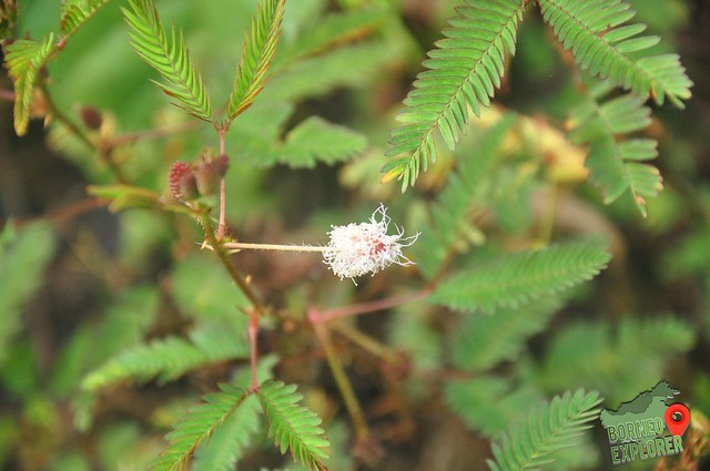
Many mushroom grows on the tree trunk
在树干上面长满了蘑菇,这我还是第一次遇见。
Very small spiders a lot of them
很小的蜘蛛。
Huge mushroom which is bigger than my 5" smart phone
大蘑菇,相等于我五寸的电话一样大。
Iban burial ground. The burial jars has names being carve on the wood respectively. Mambang Dauk (who die in 1951), Merayang Matu (in 1950), and Malong Dauk (in 1947).
伊班人的坟墓,还有陶瓷是他们的陪葬品。分别葬于1947年,1950年及1951年。
We manage to reach the summit with about 4 hours, at 710 m ASL. Next to us is one of the Iban burial jar. As advice by our local guide we did not camp at the burial site, but descent a few meter down for camp in order to pay respect to the dead.
Its very heavy to carry our hammock, and water. So we have limited water to use, we carefully calculate the water that we can use for cooking, drinking, and for descend the next day.
We are all Hennessy Hammock users, the expedition edition!
我们都是轩尼诗吊床的用户,值得信赖。
The day when we ascent to the mountain, it was a hot day, and the waterfall has not much water.
在攻顶的时候,没有下雨。山脚下不多水。
The day we descent back to the base again, and heavy downpour the whole day, water starts to flow to the Ai river (Batang Ai)
攻顶后,下到山脚后。那天都是下雨天,水开始渐渐的涨起来了。
The small waterfall on the base of the mountain
山脚下的小瀑布。
Stop by at the Park HQ to take a group photo with the signboard.
巴当艾河国家公园的招牌拍个团体照片
About Bukit Sium Ukap
715 Meter Above Sea Level
Highest Mount in Batang Ai National Park
The staring hike is a steep climb on the sium ridge, and then continues along the undulating ridge through good forest for a further few kilometer then to a high point of the ridge, Bukit Ngalan kempas. Then lastly to the highest point of Bukit Sium Ukap. Several steep hills in the area are called Bukit Sium and the exct name of this particular hill is Bukit Sium Ukap. Sium in Iban word means to sniff. At the summit there is a old survey beacon ground being cleared long time ago, and is now being taken back by nature, therefore not much view can be seen on the summit.
Julan waterfall is situated at the Usun Apau National Park plateau. Its has countless waterfall, but the most famous one will be the eastern Julan, and western Julan waterfall which are two of the highest waterfalls in Sarawak.
To get there, its not as easy journey, there is no proper tar road to that place, all the journey require a 4WD, and couple of hours of jungle trekking. The place not frequent being explorer, therefore there are also no proper trail to the place, all we can rely on its the local village people who stayed there, and use their instinct to bring us to the place.
First we are using 4WD and drive along the logging road. The distance from Miri to Julan Bridge 274km, with a 7 hours drive. In between, we stop by Lapok town for food supply, and also to pick up the rest of the porter to help carry our food supply.
路程开始,先开用四驱车在歪来歪去的木山路。七小时,全程两百七十四公里。
Height
Elevation is about 650 meter above sea level
位于高海拔六百五十米
Julan Bridge to Julan Waterfall Top 祖兰桥到瀑布的顶
Distance
From here are all jungle trekking, and the distance to Julan waterfall is about 11.65km, at 8 hours and 50 mins of hike.
这里开始登山,全程解决十二公里,解决九小时的路程。
Height
Elevation goes up from 680m to 1111m above sea level.
从海拔六百八米升到一千一白米。
THE TRAIL CONDITION
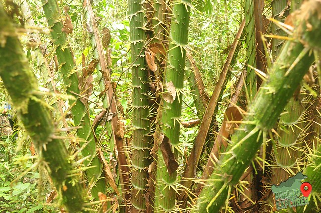
The trail condition is bad, really bad. As there are no clear trail to our base camp or the waterfall base. All are base on the instinct of our guide Mr Lipau. Along the way, there are full of plantation with thorns, spines, and prickles. We have to cross a few streams, and keep on ascending. 70% of the trail are mud trail.
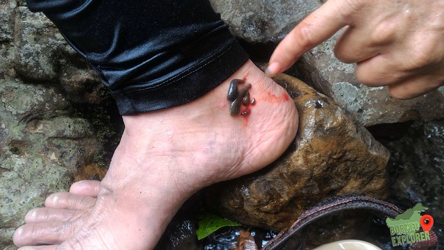
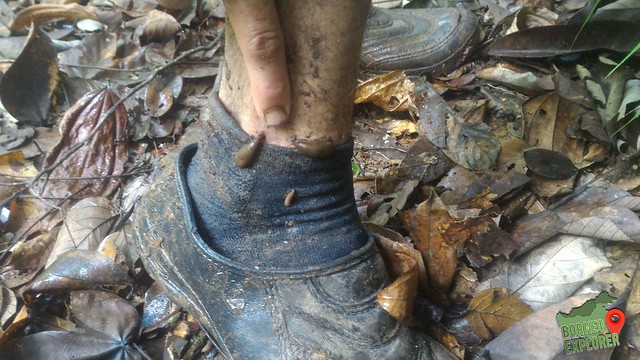
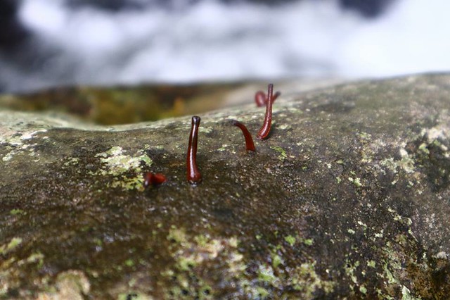
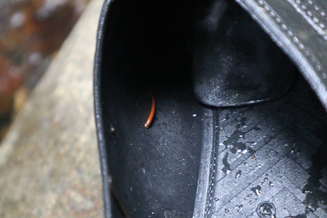
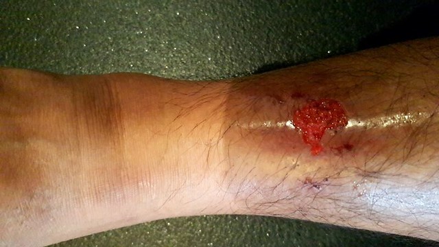
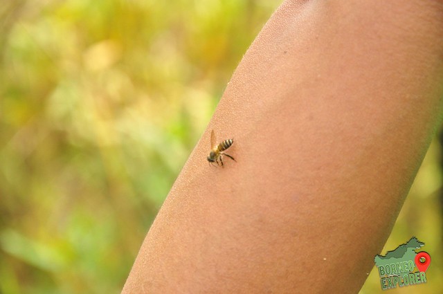
THE CHALLENGE 95% of the trail have leeches waiting for the correct timing to strike, and there are also a lot of flying blood sucking insects. I suffer at least 40 leeches bites, and one of my friend had suffer a rather bad leg injury, as a patch of his skin fall off after bitten by an unknown flying bug. Our bags are all more than 10kg, and its very heavy to carry extra water. With a 9 hours hike, most of our water almost finish, so water supply is another issue, as most of the river had leeches, so we have to boil our water, wait for it to cool down and mix with chlorine pill before we drink it.