We are going to hunt for the highest waterfall in Sarawak, the Julan waterfall. Day one, 274 km, 7 hours, from Miri to Mr Lipau's farmhouse near the Julan bridge.
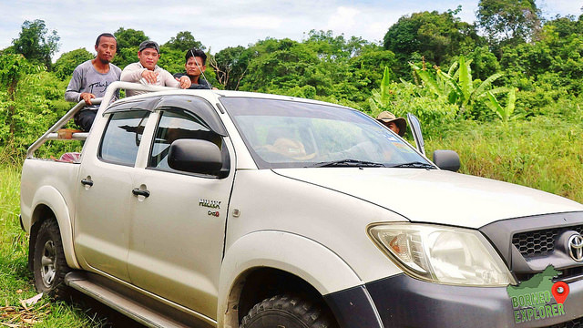
Depart from Miri, our transportation are consist of three 4WD from the Marudi town.
马鲁帝市镇来了三辆四驱车载我们去目的地。
Passby a town called Lapok aka cowboy town as its full of dust. Logging road, and timber camp nearby. Our transporter advice us if we were to drink at the coffee shop, try to get tin drinks, as they don't have fresh water supply here, only depends on rain.
Stop by at the Baram Dam blockage to pickup our guides and porters. This blockage is an important place for the village people to communicate with other village people for the stop Baram dam movement. I'm glad that the campaign manage to stop the construction of the dam for now.
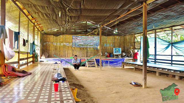
Lunch time, and this is the last eating place along the Julan river.
午餐时间,这里是最后的一间饭馆,过了这就没饭吃啦。
The owner of the Sky View Cafe also raise wild boar.
店主养的三只可爱的小野猪
Who cage the cat?!!! They should be free...
这么把猫咪关在笼子里,猫咪应该要自由自在的到处游走才对。
My lunch at about 3pm, its a fried rice. It looks good, but the actual taste...😓
快下午三点,这是我的午餐。照片是很好看,很美味,但是那个炒饭就。。。
A lot of logging truck around here, the logging company are killing our forest. After the late chef minister Adenan pass away, the local told us that the illegal logging activities starts again, and so as the rest of the logging companies.
Mount Serapi, situated at the Kubah National Park, multiple wooden shelters are located along the trail to the summit, oh and don't worry, there is only one trail to summit you will not get lost. The trail passes through dipterocarp forest and links the various trails of the park. One of the trail that I like is the Rayu Trail which link to the Matang Wildlife Center, and it takes 3 - 4 hours one way.
6 persons at one time. This Viewing Tower was built in 1997 and made of Belian wood (aka Borneo ironwood). According to the notice board it can only accommodate 6 persons at one time. I lost count on how many times I've been there, but this is the first time to take a picture from a drone.
I visited the Spak River, which is situated at about 15km away from the Betong Petronas Gas Station. Its has a road sign "Spak Clearwater River Adventure". I came here after finished hike the Bukit Sadok.
My friends and I had join an expedition which organised by the Kelab Aktiviti Lasak Kenyalang, they wanted to get into the Malaysia Book of Record for the most participant in a camping using hammock. In the end which they did, as there are about 500 plus of hammock on the summit.
We start our journey on a Friday night at about 8pm, and reach Betong town at about 12 midnight, then another hour drive to Sk St John, Jalan Ulu Layar, at Nanga Tiga. After our registration we slept at about 3am, woke up at 5am the next day. After breakfast, we start our descent at about 9.30am.
We were now at the bottom of the actual trail to the summit, all my friends wear their orange "Book of Record" t-shirt, as for me, I don't like to get sunburn so I will stick with my long sleeve hiking shirt.
这是山脚下,我的战友们都穿上举办当局给的橙色衣服。我怕晒黑,所以还是穿这自己的长袖衣。
The jungle track brings us mainly through pepper gardens, pineapple gardens, and other type of crops. The trail ascends to the mountain are quite sharply, there is one part of the mountain where they lay a foundation of concert on the trail which makes it danger to navigate on a raining day. Which I personally think they should build it in a staircase shape, instead just lay it flat.
We sometime will asked ourselves the age old question which is asked by all people climbing mountains: “so why exactly am I doing this?” I just enjoy embarrassing nature.
Saw this man in his 60's with one leg, slowly hiking up the 7km summit. Now do you still dare to say you can't reach the summit?! He's slow, but he manages to join us at the summit, which I have no idea how he did it. He told us that he climbed mount Santubong a few times already. In the end he did reach the summit, as I saw him with my own eyes, a lot of people took picture with him, and even interview him.
I know that its going to be a long climb, so we just go by maintain a speed, not too fast, not too slow. I can see a vast field of pepper plantation at the slop, along the way I didn't see any river. Where do they get all the water for all these plants?
There are many turns along the way, good thing that the organiser had marked clearly where to go next. If not we can easily go to the wrong trail, as I heard that Charles Brook took three days to get to the top while it took us about 3 hours. 😆😋
In this expedition, there are about 500+ who manage to reach the summit. Most of them are new to hiking, as I can see some the hiking bag are still very new, one of them even still have the price tag on.
And some are the expert, like this friend here, which he use to walk inside the jungle, carrying a basket of heavy stuff is like nothing for him.
I finally reach the main summit. Here we have one shelter, and the other was a small memorial hut built nearby with a copy of the Timpang Brang cannon placed in it and with several signboards giving the gist of what happened on the mountain, but is in Iban language.
There was a stone slab there with a quot from the bible, according to the local, this was placed there by an Iban priest who was trying to insult the Ibans who go to the top to perform non christian ceremonies.
This is the replica of Rentap's one armed cannon standing on top of the mountain. And a plate with a story about Rentap that goes like this...
The Rentap's town at bukit Sadoh. wait, it means like his house or fort made with belian wood as thick as 2 ft. Basically, after he was defeated by the white Rajah of Sarawak James Brook in 1854 in Sungai Lang, Ulu Skrang.
Actually James Brook never came to the mountain himself, his forces were led by his nephew Charles Brook, Rentap made a new place for him and his people to live and became king of that area.
And then the rajah has tried to attack him a few more times and only on the 3rd try he managed to get into that kuta with the use of a 12 pound cannon, (then some story about how they use magic and so on to make the defense weak etc) when rajah managed to get in, he found that Rentap has ran away, and was never captured by the Brooke forces, and finally on the 28 Oct 1861 the rajah burn down the Kuta.
At sunset I could even see the sunlight penetrate over the clouds surface and shine on the mountain range far in the distance, the view was truly amazing.
在夕阳的时候,我看到阳光穿过云层表面,在山脉上发光,这个景色真是太棒了。
As an experience camper, we manage to setup our hammock very quickly. And we still have time to build a dinning table, chairs, a place to hang our backpacks and a lamppost. After that we have nothing to do, but to look at the others struggling to setup tent and hammock around us.
There was a heavy downpour at about 7pm, and ends at about 4am the next day. We are lucky that our heavy duty hammock manage to kept us dry, but for most of the others, they have to sleep in a wet and cold condition.
Bukit Sadok is a historical place where the Iban warrior Rentap builded build fortifications to protect themselves from the attacks of Charles Brooke. The height of the mountain is 872 meters above sea level. At the peak of Bukit Sadok is a replica the one armed cannon name the Bachelor Lame Beaver (Timpang Brang Meriam). The cannon was used by Rentap to resist the invaders which is the Brooke army that led by Charles Brooke. The original cannon was placed in Betong District Office building in Bukit Bangun.